Get local expertise from an internationally experienced team you can trust to get the job done safely, on time, and done right the first time.
Getting to know McElhanney’s Bathymetric Surveying Services
The support you need, when you need it.
Measuring since 1910
McElhanney provides a variety of acoustic survey services, including single and multibeam bathymetric surveys, two dimensional acoustic imaging and sub bottom profiling, and Remotely Operated Vehicle (ROV) inspections. By using both static and dynamic deployment methods, we have been able to tailor our services to accommodate the job you need done. Our experienced team of professionals listen to the problem, and work together with you to provide a suitable and cost-effective solution no matter the task or challenge.
We offer you:
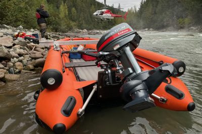
Bathymetric Surveys
When full bottom coverage is required, we utilize an Ultra High-Resolution Multibeam Sonar System to acquire accurate datasets that can be used for a variety of applications, including mapping, scour analysis, hydrological studies, underwater inspections, and more.
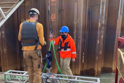
2D Imaging and 3D Scanning Sonar
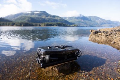
Remotely Operated Vehicle (ROV) and Unmanned Surface Vessel (USV) Surveys
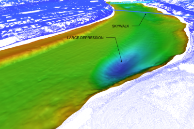
Reporting and Data Analysis
The team at McElhanney doesn’t stop at data collection. We provide extensive reporting and data analysis within a variety of complex software. We provide a high level of professional oversight with each client deliverable, so the end user fully understands how to use and view the data. Deliverables include surface models, 3D fly-through, CAD files, and a wide variety of others.
Demonstrated experience
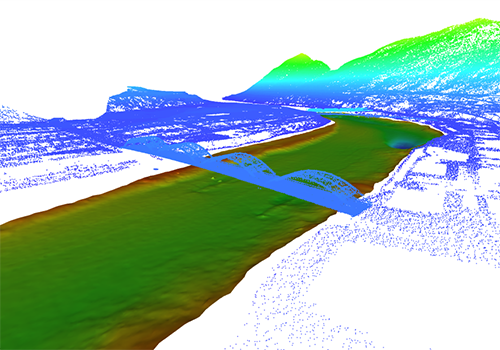
Columbia River Bathymetric Survey, Castlegar/Trail, BC
Project Summary
BC Hydro needed to repeatedly and accurately map areas in the Columbia River that could potentially cause harm to fish during low water conditions, as well as provide highly accurate hydrotechnical analysis. The mapped area required 100% bottom coverage to identify all large pools and shallow areas.
McElhanney’s bathymetric team worked with BC Hydro to provide complete full coverage of the riverbed throughout a 10km section of river. As shallow water bathymetric surveys are inherently challenging, McElhanney identified the appropriate equipment that was capable of mapping in such conditions. Furthermore, the team developed a methodology to collect the dataset while remaining safe within a challenging river environment.
Benefit to the Client
Facing a challenging environment, BC Hydro needed a multi-disciplinary team whom they could trust to successfully complete a shallow water bathymetric survey in the Columbia River. McElhanney leveraged our professional experience and identified the proper equipment and methodology to safely complete the survey.
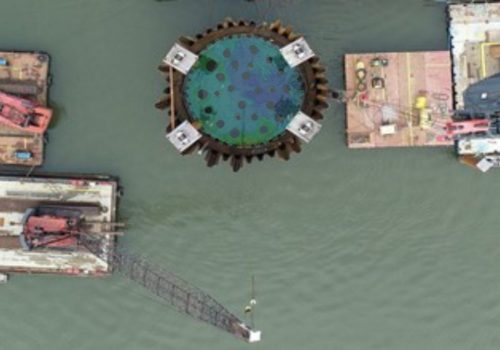
Annacis Outfall Cofferdam Survey, Delta, BC
Project Summary
In 2021, McElhanney was contracted by Ruskin Construction to provide dredge monitoring services within an isolated cofferdam along the Fraser River. The acoustic sensor was mounted to the side of the cofferdam and surveyed into position. Numerous scans were completed throughout the weeks and analyzed to indicate the amount of sediment being removed from the riverbed. When resolution limitations no longer allowed the team to get a clear image, McElhanney transitioned to an alternative sensor and deployment method.
McElhanney was able to provide a clear “image” of the bottom allowing the client to determine the next steps. Furthermore, McElhanney continued to work closely with the client to utilize the system in positioning piles, monitoring sediment removal, and providing as-built pile locations of the assets in a challenging environment.
Benefit to the Client
McElhanney provided inspection services in various forms (dual axis scanning and 3D underwater imaging) on a project with a continually changing scope. The initial dredge monitoring project was completed successfully, which then transitioned into underwater asset inspection phase.
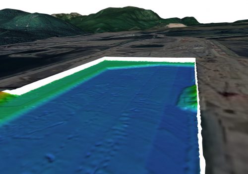
LNG Canada – Dredge Pocket Monitoring, Kitimat, BC
Project Summary
McElhanney has successfully completed numerous surveys for LNG Canada in Kitimat, BC. All surveys included setup, calibration, and multibeam data collection using our Norbit Winghead ultra-high resolution multibeam sonar system.
Our in-field technicians were able to provide quick response time when additional surveys were requested, and the quality of our equipment allowed for repeatable, reliable, and high-quality services during each deployment. Deliverables included volumetric calculations, cross sectional profiles, contour and color shaded relief maps, and data 3D fly-throughs.
Benefit to the Client
McElhanney identified observations in the multibeam dataset and presented these to the client using various methods including drawings,
video fly-through and a presentation showcasing the dataset in 3DReshaper point cloud software. The client now has a better understanding of what can be achieved from these very accurate and dense datasets.
Get in touch
Tell us how we can help you today.
Contact our experts

Your Bathymetric Expert: Marcell Iseli, B. Tech – Business Lead
T: 604-312-4745 | E: miseli@mcelhanney.com

Your Marine Survey Technologist Expert: Bradley Becker – Senior Marine Survey Technologist
T: 604-928-4141 | E: bbecker@mcelhanney.com