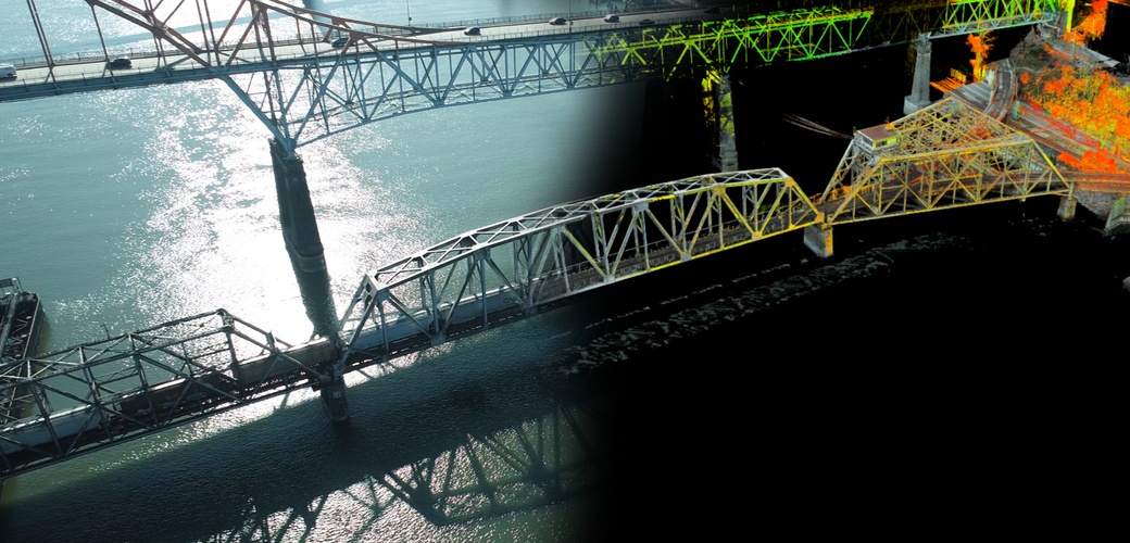
Break out the bubbly because we’re celebrating another award win! Our survey of the Fraser River Rail Bridge was selected as a winner of this year’s David Thompson award from the Association of Canada Lands Surveyors (ACLS). Celebrating excellence in the field of geomatics in Canada, the David Thompson National Geomatics Awards were introduced in the winter of 2006-2007. The program was developed in cooperation with Professional Surveyors Canada (then Canadian Council of Land Surveyors).
Chris Gilling, Project Manager, says: “This was a really challenging project that forced us to think outside the box and bring together all the technologies in our toolkit in novel ways. It really highlights McElhanney’s strength in applying different resources to find solutions for our clients.”
The Fraser River Rail Bridge is a century-old truss bridge that connects New Westminster to Surrey. The active one-kilometer-long swing bridge pivots frequently to allow busy boat traffic through.
SNC-Lavalin approached McElhanney Ltd. to acquire comprehensive 3D data and detailed photographs of the bridge to conduct a structural inspection. Since access to the deck was completely prohibited, McElhanney’s solution was to use a long-range laser scanning system from the shore, combined with photogrammetric reconstruction using imagery from an Unmanned Aerial Vehicle (UAV) and a boat to provide data for all features not visible from any other perspective.
Over the years, McElhanney has completed similar projects using laser scanning systems, but this project was uniquely challenging due to the limited availability of setup positions that resulted in a great deal of data shadowing. Only 20 percent of the bridge could be captured this traditional way, while the rest of the bridge was captured with photographs taken from every possible perspective with 90 percent overlap, which was done using a manually piloted UAV and from a boat. Altogether, over 8,000 overlapping photographs and scans were taken, which were then processed together to create a single unified point cloud file. Achieving this result involved a long and iterative process of using an advanced photogrammetry package that aligned raw photographs with laser scans to get highly detailed data of the entire bridge that maintains its accuracy even over the water.
Congratulations to the project team – Chris Gilling, Trevor Burton, Stas Ivanov, Sam Brewster, and Jason Fitch – for this well-deserved win!
